Chapter 7: Sand River (full chapter download)
The Sand River is the largest tributary of the Beaver River. It originates in the remote northern portion of the watershed, the majority of which is set aside for the Cold Lake Air Weapons Range. It drains a large area dotted with wetlands, and is also joined by the Wolf River, the outflow to the popular Wolf Lake. The confluence of the Sand and Beaver Rivers marks a notable change in the river’s characteristics, and is considered the border between the upper and lower watersheds.
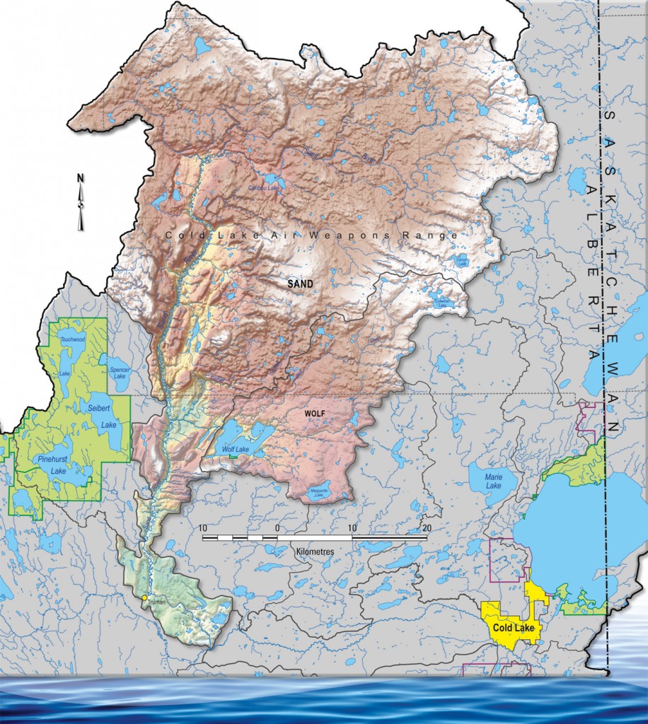
The Sand River sub-watershed is mostly undeveloped, with a high percentage of forest and wetland cover. It is home to a variety of species of wildlife, including the threatened woodland caribou. Access to the Weapons Range is mostly restricted, with limited oil and gas development occurring in a few areas. The southern end of the Sand River basin is more populated, with primarily agricultural land use. The river itself is much larger volume-wise than the Beaver River before they join, providing a much more reliable streamflow to the main stem.
The Wolf River sub-watershed includes the drainage in and out of Wolf Lake, which is a popular recreational destination. This areas is also home to a growing oil development presence, which constitutes the majority of land clearing in the sub-watershed.
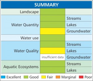
The remoteness of the sub-watershed is a primary driver behind its favourable watershed health scores. Most of the region is quasi-protected due to the Weapons Range, and the high percentage of wetland cover allows for much better water storage and filtration. The nature of the Sand River itself also contributes to a high score for surface water quantity.