Chapter 6: Mooselake River (full chapter download)
The Mooselake River is the outflow from Moose Lake, one of the region’s most popular recreational lakes. The river itself continues a system originating at Kehiwin Lake at the southern extreme of the watershed and flowing northwards via the Thin Lake River. The area holds historical importance concerning the fur trade and early agricultural settlement.
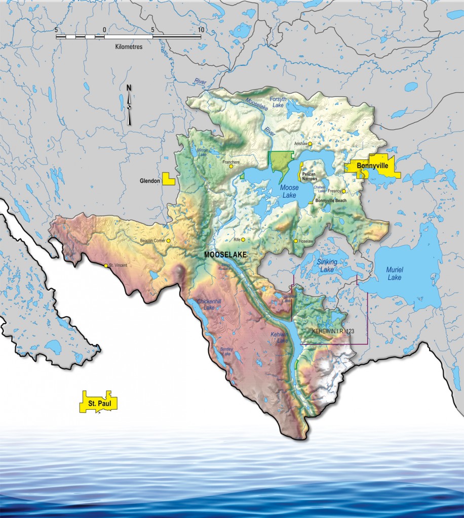
Land use in the Mooselake River sub-watershed is mostly agricultural, with over 60% of the land cleared for the purpose. There are also many other key features on the landscape, however, including the western portion of the Town of Bonnyville, the Kehewin Cree Nation, two summer villages, and a network of parks and recreation areas. Oil development is also present in various locations. Moose Lake is the major feature of the region, as it used heavily for recreation throughout the year. It also provides the Town of Bonnyville with drinking water, and drains a large agricultural area.
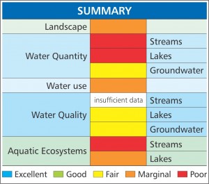
Despite the high level of activity in the area, there is a lack of watershed health data concerning stream water quality in this sub-watershed. Other health indicators range from fair to poor, with lake level being a major concern due to a high potential for evaporation in the summer. Blue green algae is also a common sight on the lake each summer, mainly due to the ideal climate and lake characteristics.