Chapter 8: Lakeland (full chapter download)
The Lakeland sub-watershed includes the drainages of the western tributaries of the Sand River. This area is comprised mostly by the Lakeland Provincial Recreation Area and a small portion of neighboring Lakeland Provincial Park. Recreational opportunities represent the majority of human activity in the area, with some forestry and oil and gas development present as well.
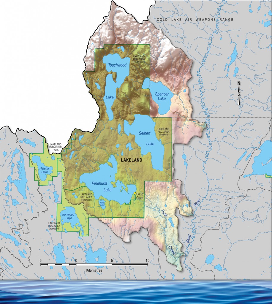
The Lakeland sub-watershed is one of the hillier areas in the Beaver watershed as a whole. Most land cover is mixedwood boreal forest, with few wetlands due to the region’s topography. The area is a key habitat for many bird species, and is recognized internationally as an Important Bird Area. 2% of North America’s red-necked grebe population is present during breeding season. The presence of old growth forest also provides key habitats for many other species.
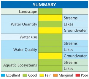
Most health indicators score relatively high for the Lakeland sub-watershed. The lack of development and relative isolation are key factors behind most of these scores. While groundwater is not regularly monitored, testing done in the past indicates that water hardness is high in the region.